
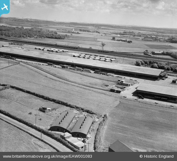
EAW001083 ENGLAND (1946). An unidentified depot located between Stopgate Lane and the railway line, Bickerstaffe, from the north-west, 1946
© Copyright OpenStreetMap contributors and licensed by the OpenStreetMap Foundation. 2026. Cartography is licensed as CC BY-SA.
Nearby Images (4)
EAW001083

EAW001079

EAW001085

EAW001078

Details
| Title | [EAW001083] An unidentified depot located between Stopgate Lane and the railway line, Bickerstaffe, from the north-west, 1946 |
| Reference | EAW001083 |
| Date | 3-June-1946 |
| Link | |
| Place name | BICKERSTAFFE |
| Parish | SIMONSWOOD |
| District | |
| Country | ENGLAND |
| Easting / Northing | 342578, 400706 |
| Longitude / Latitude | -2.8657552394161, 53.499663477221 |
| National Grid Reference | SD426007 |
Pins
User Comment Contributions
From the OS Maps on Old-Maps, this is Kirkby Inland Sorting Depot with ROF Kirkby in the distance. |

lesgilpin |
Tuesday 19th of May 2015 09:56:12 PM |