
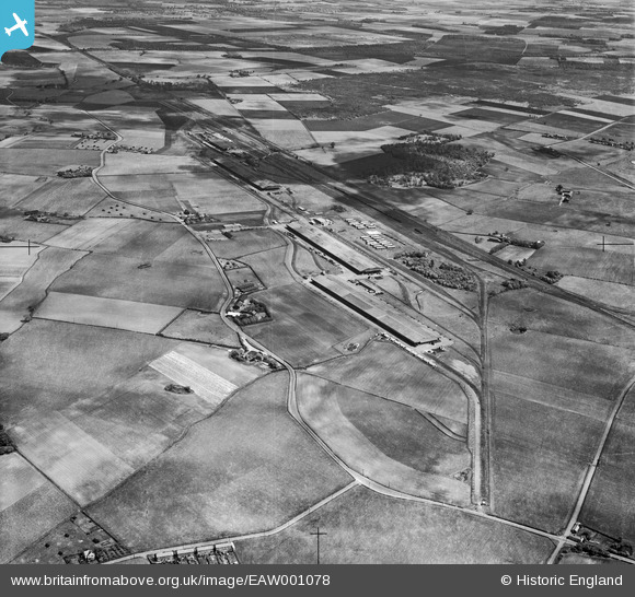
EAW001078 ENGLAND (1946). An unidentified depot located between Stopgate Lane and the railway line, Bickerstaffe, 1946
© Copyright OpenStreetMap contributors and licensed by the OpenStreetMap Foundation. 2026. Cartography is licensed as CC BY-SA.
Nearby Images (4)
EAW001078

EAW001083

EAW001085

EAW001079

Details
| Title | [EAW001078] An unidentified depot located between Stopgate Lane and the railway line, Bickerstaffe, 1946 |
| Reference | EAW001078 |
| Date | 3-June-1946 |
| Link | |
| Place name | BICKERSTAFFE |
| Parish | SIMONSWOOD |
| District | |
| Country | ENGLAND |
| Easting / Northing | 342514, 400666 |
| Longitude / Latitude | -2.8667127174021, 53.499296948108 |
| National Grid Reference | SD425007 |
Pins


User Comment Contributions
The fire-damaged Kirkby Inland Storage Depot of the Mersey Docks and Harbour Board, Bickerstaffe, from the north-east, 1946 |

boltie |
Wednesday 17th of February 2016 02:05:14 AM |