
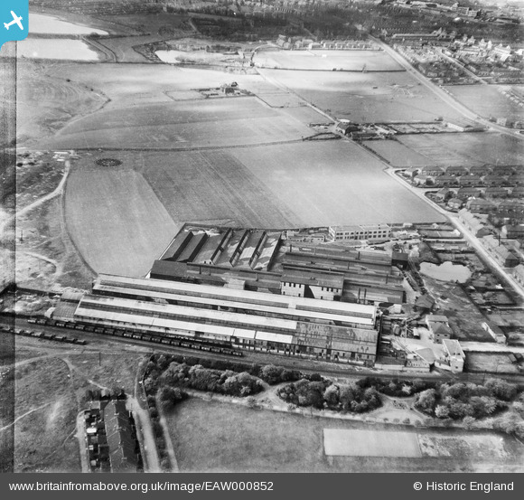
EAW000852 ENGLAND (1946). Baker Perkins Ltd Bedewell Engineering Works, Monkton, 1946
© Copyright OpenStreetMap contributors and licensed by the OpenStreetMap Foundation. 2026. Cartography is licensed as CC BY-SA.
Nearby Images (15)
EAW000852

EAW002137

EAW002136

EAW000854

EAW002139

EAW000849

EAW002141

EAW002144

EAW002142

EAW000848

EAW002143

EAW000850

EAW002140

EAW000851

EAW000853

Details
| Title | [EAW000852] Baker Perkins Ltd Bedewell Engineering Works, Monkton, 1946 |
| Reference | EAW000852 |
| Date | 15-May-1946 |
| Link | |
| Place name | MONKTON |
| Parish | |
| District | |
| Country | ENGLAND |
| Easting / Northing | 432137, 564461 |
| Longitude / Latitude | -1.4978905848081, 54.973650065606 |
| National Grid Reference | NZ321645 |
Pins

Matt Aldred edob.mattaldred.com |
Saturday 27th of February 2021 09:52:10 PM | |

redmist |
Thursday 24th of October 2019 11:28:13 AM | |

Sparky |
Friday 28th of July 2017 07:16:25 AM | |
|
Sparky |
Friday 28th of July 2017 07:15:58 AM | |
|
Sparky |
Friday 28th of July 2017 07:15:22 AM | |
|
Sparky |
Friday 28th of July 2017 07:14:02 AM | |
|
only1jdw |
Wednesday 23rd of December 2015 05:06:41 PM |