
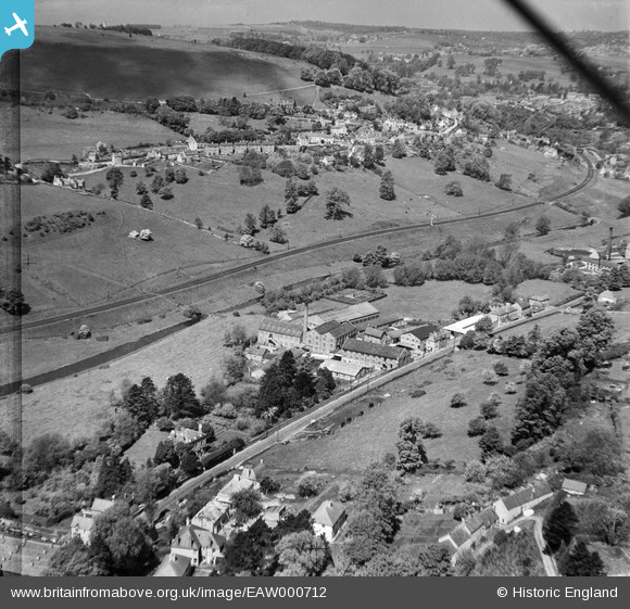
EAW000712 ENGLAND (1946). Tyler's Ltd Griffin's Mill looking towards Butterow, Thrupp, from the south-east, 1946
© Copyright OpenStreetMap contributors and licensed by the OpenStreetMap Foundation. 2026. Cartography is licensed as CC BY-SA.
Nearby Images (7)
EAW000712

EAW000708

EAW000707

EAW000711

EAW000710

EAW000706

EAW000709

Details
| Title | [EAW000712] Tyler's Ltd Griffin's Mill looking towards Butterow, Thrupp, from the south-east, 1946 |
| Reference | EAW000712 |
| Date | 9-May-1946 |
| Link | |
| Place name | THRUPP |
| Parish | BRIMSCOMBE AND THRUPP |
| District | |
| Country | ENGLAND |
| Easting / Northing | 385999, 203484 |
| Longitude / Latitude | -2.2027456234029, 51.729439674368 |
| National Grid Reference | SO860035 |
Pins
User Comment Contributions
Griffin's Mill lock, now fully restored |

Robert |
Thursday 9th of March 2017 11:08:01 AM |