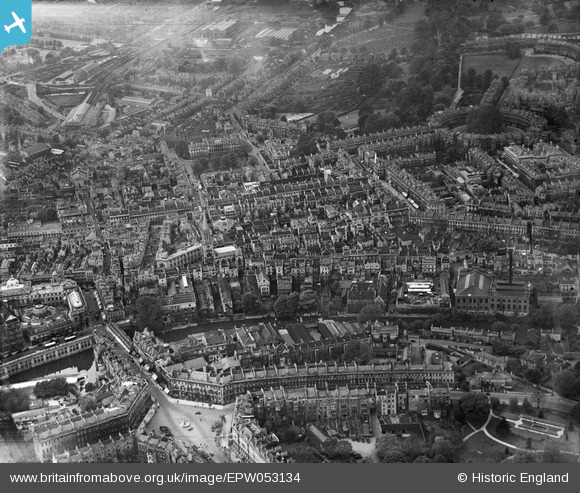
EPW053134 ENGLAND (1937). The city centre, Bath, 1937
© Copyright OpenStreetMap contributors and licensed by the OpenStreetMap Foundation. 2024. Cartography is licensed as CC BY-SA.
Nearby Images (25)
EPW053134

EPW053133

EPW053130

EPW053127

EPW053138

EPW053128

EPW001958

EPW053129

EPR000133

EPW053131

EPW053135

EPW053136

EPW053132

EPW033154

EPW048393

EAW000761

EPW053137

EAW000744

EPR000129

EAW000745

EPW001951

EPW053141

EPW001952

EPW001950

EAW049897

Details
| Title | [EPW053134] The city centre, Bath, 1937 |
| Reference | EPW053134 |
| Date | 19-May-1937 |
| Link | |
| Place name | BATH |
| Parish | |
| District | |
| Country | ENGLAND |
| Easting / Northing | 375015, 165071 |
| Longitude / Latitude | -2.3590697625107, 51.383638641058 |
| National Grid Reference | ST750651 |