
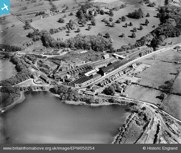
EPW050254 ENGLAND (1936). The Butterley Co Iron Works, Butterley, 1936
© Copyright OpenStreetMap contributors and licensed by the OpenStreetMap Foundation. 2024. Cartography is licensed as CC BY-SA.
Nearby Images (28)
EPW050254

EPW050251

EPW050253

EAW012257

EAW012242

EAW012243

EPW050252

EPW050255

EAW012254

EAW012260

EAW012259

EAW012256

EAW012262

EAW012249

EAW012250

EAW012247

EAW012258

EAW012244

EAW012246

EAW012251

EAW012264

EAW012245

EAW012263

EAW012255

EAW012253

EAW012252

EAW012261

EAW012248

Details
| Title | [EPW050254] The Butterley Co Iron Works, Butterley, 1936 |
| Reference | EPW050254 |
| Date | May-1936 |
| Link | |
| Place name | BUTTERLEY |
| Parish | RIPLEY |
| District | |
| Country | ENGLAND |
| Easting / Northing | 440096, 351593 |
| Longitude / Latitude | -1.4016491539296, 53.059778528677 |
| National Grid Reference | SK401516 |
Pins
Be the first to add a comment to this image!


