
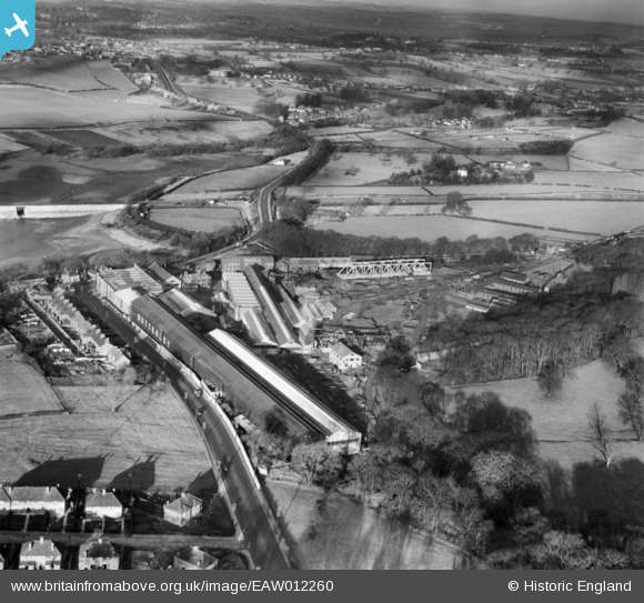
EAW012260 ENGLAND (1947). The Butterley Iron Works and environs, Butterley, 1947
© Copyright OpenStreetMap contributors and licensed by the OpenStreetMap Foundation. 2024. Cartography is licensed as CC BY-SA.
Nearby Images (20)
EAW012260

EAW012244

EAW012243

EAW012246

EAW012247

EAW012242

EAW012258

EAW012257

EAW012245

EAW012264

EAW012263

EPW050252

EPW050255

EPW050254

EPW050251

EPW050253

EAW012259

EAW012256

EAW012262

EAW012251

Details
| Title | [EAW012260] The Butterley Iron Works and environs, Butterley, 1947 |
| Reference | EAW012260 |
| Date | 24-November-1947 |
| Link | |
| Place name | BUTTERLEY |
| Parish | RIPLEY |
| District | |
| Country | ENGLAND |
| Easting / Northing | 440222, 351649 |
| Longitude / Latitude | -1.3997619768705, 53.06027247848 |
| National Grid Reference | SK402516 |
Pins
 Whitwellian |
Monday 4th of November 2013 11:51:36 PM |


