
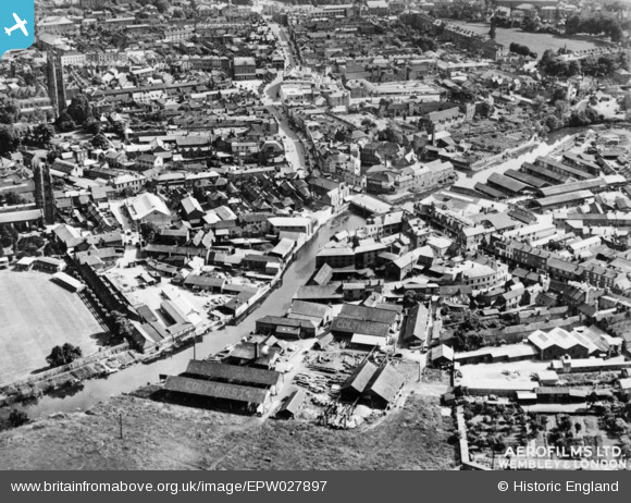
EPW027897 ENGLAND (1929). Tone Bridge and the town centre, 1929. This image has been produced from a copy-negative.
© Copyright OpenStreetMap contributors and licensed by the OpenStreetMap Foundation. 2024. Cartography is licensed as CC BY-SA.
Nearby Images (9)
EPW027897

EPW027895

EPW013543

EAW005338

EAW005339

EAW005341

EPW027896

EAW005337

EAW005340

Details
| Title | [EPW027897] Tone Bridge and the town centre, 1929. This image has been produced from a copy-negative. |
| Reference | EPW027897 |
| Date | 28-June-1929 |
| Link | |
| Place name | TAUNTON |
| Parish | |
| District | |
| Country | ENGLAND |
| Easting / Northing | 322701, 124865 |
| Longitude / Latitude | -3.1021349201241, 51.017420014091 |
| National Grid Reference | ST227249 |
Pins
 Somerset Chick |
Sunday 19th of March 2017 12:27:31 AM | |
Somerset Chick |
Sunday 19th of March 2017 12:26:42 AM | |
Somerset Chick |
Sunday 19th of March 2017 12:25:45 AM | |
Somerset Chick |
Thursday 15th of September 2016 05:01:10 PM | |
Somerset Chick |
Thursday 15th of September 2016 05:00:38 PM |


