
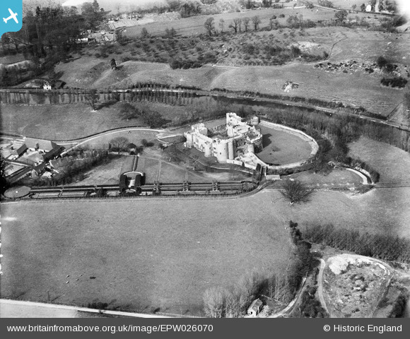
EPW026070 ENGLAND (1929). Allington Castle, Allington, 1929
© Copyright OpenStreetMap contributors and licensed by the OpenStreetMap Foundation. 2024. Cartography is licensed as CC BY-SA.
Nearby Images (19)
EPW026070

EPW005633

EPW009213

EPW005594

EAW048698

EAW023119

EPW009214

EAW048700

EAW005193

EAW048697

EAW048699

EAW023158

EAW023156

EAW023157

EAW023155

EAW002349

EAW002348

EAW002347

EAW023120

Details
| Title | [EPW026070] Allington Castle, Allington, 1929 |
| Reference | EPW026070 |
| Date | April-1929 |
| Link | |
| Place name | ALLINGTON |
| Parish | |
| District | |
| Country | ENGLAND |
| Easting / Northing | 575169, 157895 |
| Longitude / Latitude | 0.51262097603277, 51.292695552952 |
| National Grid Reference | TQ752579 |
Pins
Be the first to add a comment to this image!


