
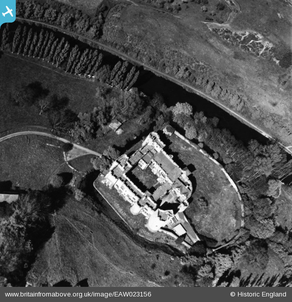
EAW023156 ENGLAND (1949). Allington Castle, Allington, 1949. This image has been produced from a print.
© Copyright OpenStreetMap contributors and licensed by the OpenStreetMap Foundation. 2024. Cartography is licensed as CC BY-SA.
Nearby Images (19)
EAW023156

EAW023157

EAW023158

EAW048699

EAW005193

EAW023119

EAW048700

EPW009214

EPW009213

EAW048698

EPW005633

EAW023155

EPW026070

EPW005594

EAW048697

EAW023120

EAW002349

EAW002348

EAW002347

Details
| Title | [EAW023156] Allington Castle, Allington, 1949. This image has been produced from a print. |
| Reference | EAW023156 |
| Date | 11-May-1949 |
| Link | |
| Place name | ALLINGTON |
| Parish | |
| District | |
| Country | ENGLAND |
| Easting / Northing | 575212, 157942 |
| Longitude / Latitude | 0.51326019822748, 51.293104578372 |
| National Grid Reference | TQ752579 |
Pins
Be the first to add a comment to this image!


