
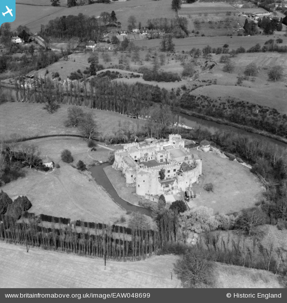
EAW048699 ENGLAND (1953). Allington Castle, Allington, 1953
© Copyright OpenStreetMap contributors and licensed by the OpenStreetMap Foundation. 2024. Cartography is licensed as CC BY-SA.
Nearby Images (19)
EAW048699

EAW023158

EAW023156

EAW023157

EAW023119

EAW005193

EPW009213

EAW048700

EPW009214

EAW048698

EPW005633

EAW023155

EPW026070

EPW005594

EAW048697

EAW023120

EAW002349

EAW002348

EAW002347

Details
| Title | [EAW048699] Allington Castle, Allington, 1953 |
| Reference | EAW048699 |
| Date | 8-April-1953 |
| Link | |
| Place name | ALLINGTON |
| Parish | |
| District | |
| Country | ENGLAND |
| Easting / Northing | 575195, 157933 |
| Longitude / Latitude | 0.51301218325414, 51.293028951953 |
| National Grid Reference | TQ752579 |
Pins
 I in the sky |
Monday 22nd of November 2021 12:05:32 AM | |
cptpies |
Friday 15th of November 2019 12:47:51 PM |


