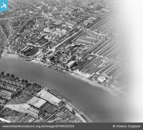
EPW022556 ENGLAND (1928). The Manbre Saccharine Works and environs, Fulham, 1928
© Copyright OpenStreetMap contributors and licensed by the OpenStreetMap Foundation. 2024. Cartography is licensed as CC BY-SA.
Nearby Images (20)
EPW022556

EPW007981

EPW022561

EPW022559

EPW007947

EPW022554

EPW022805

EPW022799

EPW022802

EPW024775

EPW022800

EPW022803

EPW022555

EPW024774

EPW022558

EPW022801

EPW024773

EPW022804

EPW010782

EPW022560

Details
| Title | [EPW022556] The Manbre Saccharine Works and environs, Fulham, 1928 |
| Reference | EPW022556 |
| Date | August-1928 |
| Link | |
| Place name | FULHAM |
| Parish | |
| District | |
| Country | ENGLAND |
| Easting / Northing | 523281, 177858 |
| Longitude / Latitude | -0.22426305137426, 51.48573321697 |
| National Grid Reference | TQ233779 |