
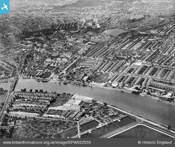
EPW022555 ENGLAND (1928). The Manbre Saccharine Works and environs, Fulham, from the south-west, 1928
© Copyright OpenStreetMap contributors and licensed by the OpenStreetMap Foundation. 2024. Cartography is licensed as CC BY-SA.
Nearby Images (19)
EPW022555

EPW022800

EPW022560

EPW024774

EPW024773

EPW010782

EPW024775

EPW022804

EPW022802

EPW022803

EPW022799

EPW022556

EPW022805

EPW022801

EPW059342

EPW007981

EPW022554

EPW022561

EPW022558

Details
| Title | [EPW022555] The Manbre Saccharine Works and environs, Fulham, from the south-west, 1928 |
| Reference | EPW022555 |
| Date | August-1928 |
| Link | |
| Place name | FULHAM |
| Parish | |
| District | |
| Country | ENGLAND |
| Easting / Northing | 523231, 177682 |
| Longitude / Latitude | -0.2250443154308, 51.48416219139 |
| National Grid Reference | TQ232777 |


