
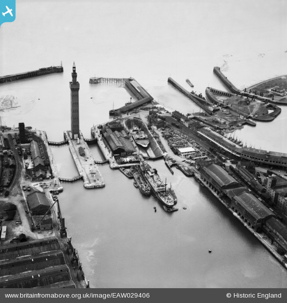
EAW029406 ENGLAND (1950). The Docks, Grimsby, 1950
© Copyright OpenStreetMap contributors and licensed by the OpenStreetMap Foundation. 2024. Cartography is licensed as CC BY-SA.
Nearby Images (21)
EAW029406

EAW029407

EAW029404

EAW029405

EAW029014

EAW029073

EAW029068

EAW029077

EAW029075

EPW012668

EPW053397

EAW029016

EAW029410

EAW029071

EAW029072

EAW029067

EAW029070

EAW029074

EAW029078

EAW029013

EPW012666

Details
| Title | [EAW029406] The Docks, Grimsby, 1950 |
| Reference | EAW029406 |
| Date | 5-April-1950 |
| Link | |
| Place name | GRIMSBY |
| Parish | |
| District | |
| Country | ENGLAND |
| Easting / Northing | 527899, 411283 |
| Longitude / Latitude | -0.0678141323492, 53.582276541678 |
| National Grid Reference | TA279113 |
Pins
 John Wass |
Sunday 2nd of November 2014 08:40:27 PM | |
I well remember my trip on the coal fired Lincoln Castle from Hull to New Holland and back. I think it was a winter's day and I had around a 100 mile each way car trip to get to Hull but it was well worth it. |
 Class31 |
Sunday 2nd of November 2014 08:47:49 PM |
Class31 |
Monday 3rd of March 2014 07:36:23 PM | |
Class31 |
Monday 3rd of March 2014 07:15:10 PM |
User Comment Contributions
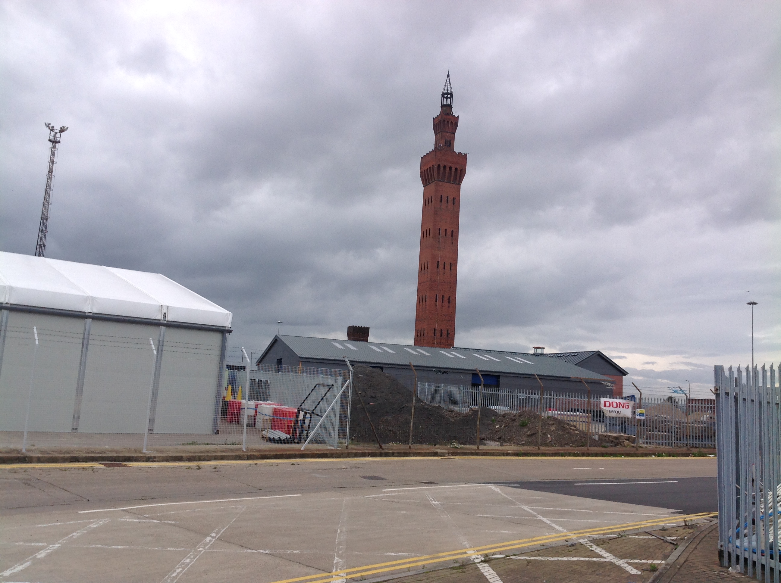 The Dock Tower, Grimsby, 29/08/2014 |
Class31 |
Sunday 2nd of November 2014 08:45:30 PM |


