
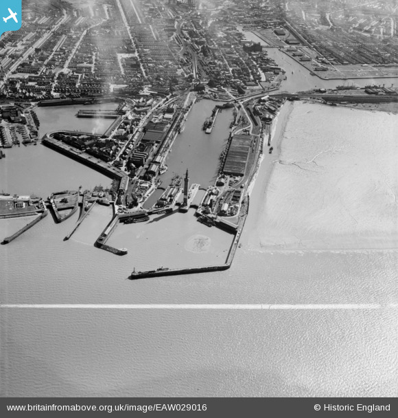
EAW029016 ENGLAND (1950). The Royal Dock and Tidal Basin, Grimsby, 1950. This image was marked by Aerofilms Ltd for photo editing.
© Copyright OpenStreetMap contributors and licensed by the OpenStreetMap Foundation. 2024. Cartography is licensed as CC BY-SA.
Nearby Images (21)
EAW029016

EPW012668

EAW029404

EAW029405

EAW029073

EAW029013

EAW029070

EAW029406

EAW029071

EAW029075

EAW029014

EAW029407

EAW029068

EPW053397

EAW029077

EAW029078

EAW029410

EAW029072

EAW029067

EPW012666

EAW029409

Details
| Title | [EAW029016] The Royal Dock and Tidal Basin, Grimsby, 1950. This image was marked by Aerofilms Ltd for photo editing. |
| Reference | EAW029016 |
| Date | 10-May-1950 |
| Link | |
| Place name | GRIMSBY |
| Parish | |
| District | |
| Country | ENGLAND |
| Easting / Northing | 527804, 411321 |
| Longitude / Latitude | -0.069232849763603, 53.582641104285 |
| National Grid Reference | TA278113 |
Pins
 Class31 |
Monday 3rd of March 2014 07:12:02 PM |


