
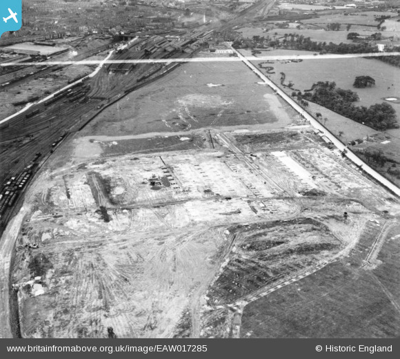
EAW017285 ENGLAND (1948). Construction of the Midland Rollmakers Ltd Works off Weston Road, Crewe, 1948. This image has been produced from a print marked by Aerofilms Ltd for photo editing.
© Copyright OpenStreetMap contributors and licensed by the OpenStreetMap Foundation. 2024. Cartography is licensed as CC BY-SA.
Nearby Images (39)
EAW017285

EAW017289

EAW035065

EAW021630

EAW021631
 and the surrounding area, Crewe, 1949. This image has been produced from a damaged negative.")
EAW021632
, Crewe, 1949. This image has been produced from a damaged negative.")
EAW035062

EAW021634

EAW021633

EAW035061

EAW028247

EAW028250

EAW028252

EAW035067

EAW035063

EAW017286

EAW028249

EAW028248

EAW035066

EAW028246

EAW017290

EAW017284

EAW035072

EAW035064

EAW035071

EAW035073

EAW035075

EAW035074

EAW021626

EAW035069

EAW021625

EAW021627

EAW017283

EAW017288

EAW021628
 and the surrounding area, Crewe, 1949. This image has been produced from a damaged negative.")
EAW017287

EAW035070

EAW028245

EAW035068

Details
| Title | [EAW017285] Construction of the Midland Rollmakers Ltd Works off Weston Road, Crewe, 1948. This image has been produced from a print marked by Aerofilms Ltd for photo editing. |
| Reference | EAW017285 |
| Date | 19-July-1948 |
| Link | |
| Place name | CREWE |
| Parish | |
| District | |
| Country | ENGLAND |
| Easting / Northing | 371497, 354205 |
| Longitude / Latitude | -2.4255867367841, 53.084004210363 |
| National Grid Reference | SJ715542 |
Pins
Be the first to add a comment to this image!


