
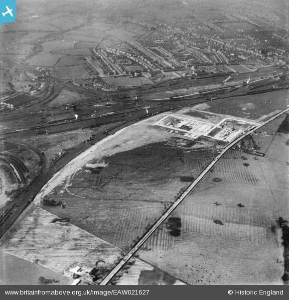
EAW021627 ENGLAND (1949). The British Rollmakers Corporation Works under construction and the surrounding area, Crewe, 1949. This image has been produced from a print.
© Copyright OpenStreetMap contributors and licensed by the OpenStreetMap Foundation. 2024. Cartography is licensed as CC BY-SA.
Nearby Images (25)
EAW021627

EAW021626

EAW017288

EAW035071

EAW028245

EAW017287

EAW035070

EAW021625

EAW035068

EAW028244

EAW017286

EAW028250

EAW028252

EAW021628
 and the surrounding area, Crewe, 1949. This image has been produced from a damaged negative.")
EAW028247

EAW017290

EAW017289

EAW017285

EAW021634

EAW021631
 and the surrounding area, Crewe, 1949. This image has been produced from a damaged negative.")
EAW035065

EAW021630

EAW021633

EAW035062

EAW021632
, Crewe, 1949. This image has been produced from a damaged negative.")
Details
| Title | [EAW021627] The British Rollmakers Corporation Works under construction and the surrounding area, Crewe, 1949. This image has been produced from a print. |
| Reference | EAW021627 |
| Date | 25-March-1949 |
| Link | |
| Place name | CREWE |
| Parish | |
| District | |
| Country | ENGLAND |
| Easting / Northing | 371612, 354005 |
| Longitude / Latitude | -2.4238520273234, 53.082212368659 |
| National Grid Reference | SJ716540 |
Pins
Be the first to add a comment to this image!


