
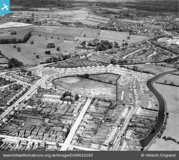
EAW016183 ENGLAND (1948). Longmoor Primary School and houses along Welbeck Road under construction, Long Eaton, 1948
© Copyright OpenStreetMap contributors and licensed by the OpenStreetMap Foundation. 2024. Cartography is licensed as CC BY-SA.
Nearby Images (17)
EAW016183

EAW006391

EAW016181

EAW006388

EAW016182

EAW016180

EAW016186

EAW006389

EAW016178

EAW006386

EAW016185

EAW006384

EAW006390

EAW006385

EAW016179

EAW016184

EAW006387

Details
| Title | [EAW016183] Longmoor Primary School and houses along Welbeck Road under construction, Long Eaton, 1948 |
| Reference | EAW016183 |
| Date | 27-May-1948 |
| Link | |
| Place name | LONG EATON |
| Parish | |
| District | |
| Country | ENGLAND |
| Easting / Northing | 448003, 335380 |
| Longitude / Latitude | -1.2860697313467, 52.913379339938 |
| National Grid Reference | SK480354 |
Pins
Be the first to add a comment to this image!


