
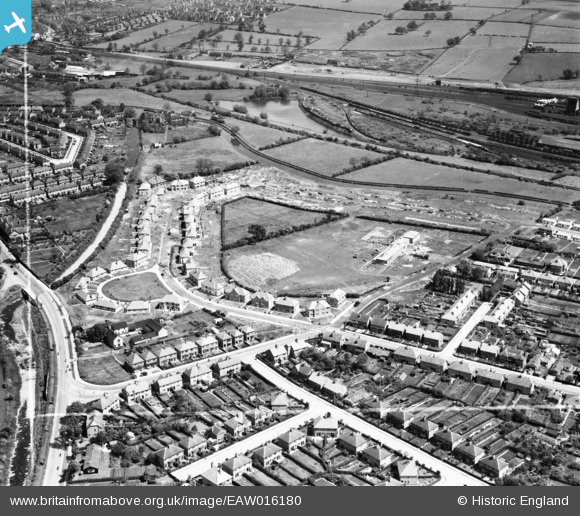
EAW016180 ENGLAND (1948). Longmoor Primary School and houses along Welbeck Road under construction, Long Eaton, 1948. This image was marked by Aerofilms Ltd for photo editing.
© Copyright OpenStreetMap contributors and licensed by the OpenStreetMap Foundation. 2024. Cartography is licensed as CC BY-SA.
Nearby Images (17)
EAW016180

EAW006391

EAW016182

EAW016183

EAW016178

EAW016181

EAW016186

EAW006388

EAW006390

EAW006384

EAW006385

EAW006389

EAW006386

EAW016185

EAW006387

EAW016179

EAW016184

Details
| Title | [EAW016180] Longmoor Primary School and houses along Welbeck Road under construction, Long Eaton, 1948. This image was marked by Aerofilms Ltd for photo editing. |
| Reference | EAW016180 |
| Date | 27-May-1948 |
| Link | |
| Place name | LONG EATON |
| Parish | |
| District | |
| Country | ENGLAND |
| Easting / Northing | 448024, 335348 |
| Longitude / Latitude | -1.2857621654101, 52.913089794134 |
| National Grid Reference | SK480353 |
Pins
 Peter Kazmierczak |
Monday 5th of May 2014 12:05:17 AM | |
Peter Kazmierczak |
Monday 5th of May 2014 12:03:21 AM | |
Peter Kazmierczak |
Monday 5th of May 2014 12:01:48 AM | |
Peter Kazmierczak |
Sunday 4th of May 2014 11:59:54 PM | |
Peter Kazmierczak |
Sunday 4th of May 2014 11:58:31 PM | |
 Tony |
Friday 10th of January 2014 12:22:42 PM | |
Tony |
Friday 10th of January 2014 12:22:15 PM |


