
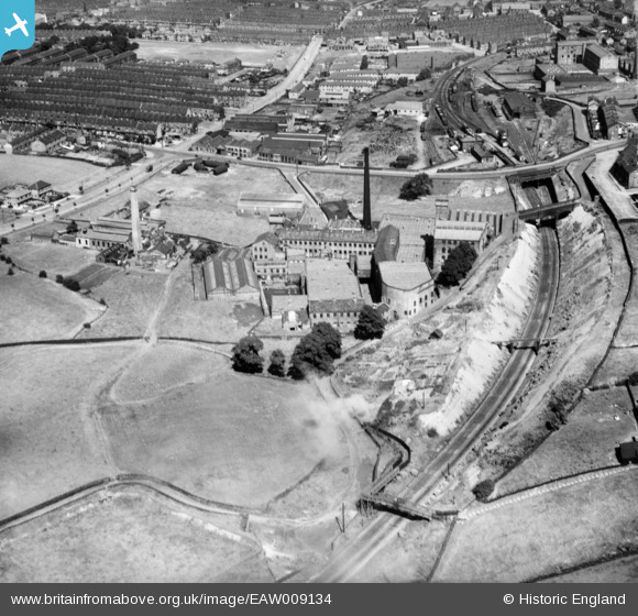
EAW009134 ENGLAND (1947). Beckside Worsted Mills at Great Horton, Bradford, 1947
© Copyright OpenStreetMap contributors and licensed by the OpenStreetMap Foundation. 2024. Cartography is licensed as CC BY-SA.
Nearby Images (11)
EAW009134

EAW009130

EAW009131

EAW009132

EAW009129

EAW009128

EAW009136

EAW009133

EAW009137

EAW009135

EPW024410

Details
| Title | [EAW009134] Beckside Worsted Mills at Great Horton, Bradford, 1947 |
| Reference | EAW009134 |
| Date | 15-August-1947 |
| Link | |
| Place name | BRADFORD |
| Parish | |
| District | |
| Country | ENGLAND |
| Easting / Northing | 414003, 431856 |
| Longitude / Latitude | -1.7874602958239, 53.782625207774 |
| National Grid Reference | SE140319 |


