
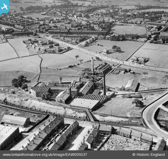
EAW009137 ENGLAND (1947). Beckside Worsted Mills at Great Horton, Bradford, 1947
© Copyright OpenStreetMap contributors and licensed by the OpenStreetMap Foundation. 2024. Cartography is licensed as CC BY-SA.
Nearby Images (10)
EAW009137

EAW009129

EAW009133

EAW009128

EAW009134

EAW009131

EAW009130

EAW009136

EAW009132

EAW009135

Details
| Title | [EAW009137] Beckside Worsted Mills at Great Horton, Bradford, 1947 |
| Reference | EAW009137 |
| Date | 15-August-1947 |
| Link | |
| Place name | BRADFORD |
| Parish | |
| District | |
| Country | ENGLAND |
| Easting / Northing | 413983, 431927 |
| Longitude / Latitude | -1.7877606360279, 53.783263962581 |
| National Grid Reference | SE140319 |
Pins
 gBr |
Sunday 16th of April 2023 03:59:19 PM | |
rachelst |
Wednesday 8th of October 2014 10:12:05 PM | |
rachelst |
Wednesday 8th of October 2014 10:11:34 PM | |
rachelst |
Monday 6th of October 2014 11:21:29 PM | |
rachelst |
Monday 6th of October 2014 11:20:00 PM | |
rachelst |
Monday 6th of October 2014 11:19:29 PM | |
rachelst |
Monday 6th of October 2014 11:16:21 PM | |
rachelst |
Monday 6th of October 2014 11:15:37 PM | |
rachelst |
Monday 6th of October 2014 11:14:10 PM | |
rachelst |
Monday 6th of October 2014 11:13:05 PM | |
rachelst |
Monday 6th of October 2014 11:12:10 PM |


