
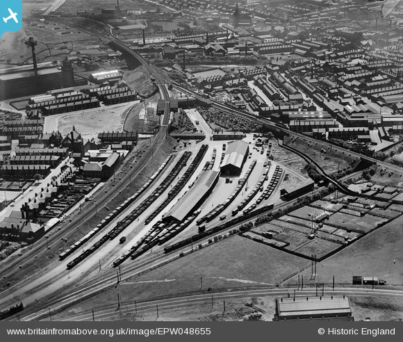
EPW048655 ENGLAND (1935). Radcliffe New Station, adjacent goods station and environs, Radcliffe, 1935
© Hawlfraint cyfranwyr OpenStreetMap a thrwyddedwyd gan yr OpenStreetMap Foundation. 2024. Trwyddedir y gartograffeg fel CC BY-SA.
Delweddau cyfagos (19)
EPW048655

EPW048652

EPW048651

EPW048647

EPW048654

EPW047484

EPW048649

EPW047489

EAW051420
 and Radcliffe Goods Yard, Radcliffe, 1953. This image was marked by Aerofilms Ltd for photo editing.")
EAW008446
 and the East Lancashire Paper Mill, Radcliffe, from the west, 1947. This image was marked by Aerofilms Ltd for photo editing.")
EAW051416
 and Spring Lane, Radcliffe, 1953. This image was marked by Aerofilms Ltd for photo editing.")
EAW051414
, Radcliffe, 1953. This image was marked by Aerofilms Ltd for photo editing.")
EAW051417
 and Grey Street, Radcliffe, 1953. This image was marked by Aerofilms Ltd for photo editing.")
EAW051415
, Radcliffe, 1953. This image was marked by Aerofilms Ltd for photo editing.")
EAW051412
 and Grey Street, Radcliffe, 1953. This image was marked by Aerofilms Ltd for photo editing.")
EAW051413
, Radcliffe, 1953. This image was marked by Aerofilms Ltd for photo editing.")
EAW051419
, Radcliffe, 1953. This image was marked by Aerofilms Ltd for photo editing.")
EAW051418
 and Spring Lane, Radcliffe, 1953. This image was marked by Aerofilms Ltd for photo editing.")
EPW047485

Manylion
| Pennawd | [EPW048655] Radcliffe New Station, adjacent goods station and environs, Radcliffe, 1935 |
| Cyfeirnod | EPW048655 |
| Dyddiad | July-1935 |
| Dolen | |
| Enw lle | RADCLIFFE |
| Plwyf | |
| Ardal | |
| Gwlad | ENGLAND |
| Dwyreiniad / Gogleddiad | 378765, 407511 |
| Hydred / Lledred | -2.3206405724699, 53.56354175961 |
| Cyfeirnod Grid Cenedlaethol | SD788075 |
Pinnau
 John Wass |
Saturday 2nd of May 2015 11:53:52 AM |


