
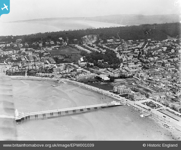
EPW001039 ENGLAND (1920). View over Weston-Super-Mare and the Grand Pier, Weston-Super-Mare, from the south-west, 1920
© Hawlfraint cyfranwyr OpenStreetMap a thrwyddedwyd gan yr OpenStreetMap Foundation. 2024. Trwyddedir y gartograffeg fel CC BY-SA.
Delweddau cyfagos (26)
EPW001039

EAW025155

EPW039934

EPW051716

EAW016133

EPW023970

EAW015057

EAW015056

EPW023960

EAW016134

EPW048443

EPW039932

EPW048457

EPW023969

EPW023967

EPW023966

EPW051708

EPW024071

EPW033286

EPW039936

EPW048452

EPW048456

EPW024072

EAW015058

EPW048451

EAW056067

Manylion
| Pennawd | [EPW001039] View over Weston-Super-Mare and the Grand Pier, Weston-Super-Mare, from the south-west, 1920 |
| Cyfeirnod | EPW001039 |
| Dyddiad | May-1920 |
| Dolen | |
| Enw lle | WESTON-SUPER-MARE |
| Plwyf | WESTON-SUPER-MARE |
| Ardal | |
| Gwlad | ENGLAND |
| Dwyreiniad / Gogleddiad | 331631, 161419 |
| Hydred / Lledred | -2.9817895134004, 51.347233430924 |
| Cyfeirnod Grid Cenedlaethol | ST316614 |
Pinnau
 Gen_Hancock |
Friday 3rd of February 2017 11:46:47 AM | |
Gen_Hancock |
Friday 3rd of February 2017 11:01:33 AM | |
 Alan McFaden |
Saturday 19th of October 2013 02:53:44 PM | |
Alan McFaden |
Saturday 19th of October 2013 02:52:53 PM | |
Alan McFaden |
Saturday 19th of October 2013 02:51:33 PM | |
Alan McFaden |
Saturday 19th of October 2013 02:50:10 PM |


