
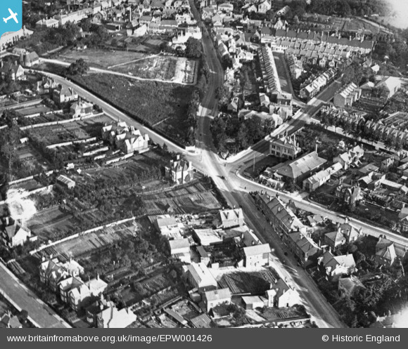
epw001426 ENGLAND (1920). The junction of Tubs Hill and Pembroke Road, Sevenoaks, 1920. This image has been produced from a copy-negative.
© Copyright OpenStreetMap contributors and licensed by the OpenStreetMap Foundation. 2025. Cartography is licensed as CC BY-SA.
Nearby Images (4)
EPW001426

EPW060385

EPW060382

EPW060383

Details
| Title | [EPW001426] The junction of Tubs Hill and Pembroke Road, Sevenoaks, 1920. This image has been produced from a copy-negative. |
| Reference | EPW001426 |
| Date | 8-June-1920 |
| Link | |
| Place name | SEVENOAKS |
| Parish | SEVENOAKS |
| District | |
| Country | ENGLAND |
| Easting / Northing | 552824, 154985 |
| Longitude / Latitude | 0.19112959442694, 51.272982392064 |
| National Grid Reference | TQ528550 |
Pins
 [eBay} - Copy_0.jpg) ChesterMan |
Monday 3rd of November 2014 11:32:17 AM | |
ChesterMan |
Monday 3rd of November 2014 10:54:46 AM | |
ChesterMan |
Monday 3rd of November 2014 10:53:01 AM | |
ChesterMan |
Monday 3rd of November 2014 10:52:26 AM | |
ChesterMan |
Monday 3rd of November 2014 10:51:51 AM | |
ChesterMan |
Monday 3rd of November 2014 10:51:25 AM | |
ChesterMan |
Monday 3rd of November 2014 10:48:54 AM | |
ChesterMan |
Monday 3rd of November 2014 10:48:47 AM | |
ChesterMan |
Monday 3rd of November 2014 10:48:44 AM | |
ChesterMan |
Monday 3rd of November 2014 10:47:49 AM |