
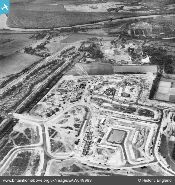
eaw049989 ENGLAND (1953). The residential area at Ferry Fryston under construction, Castleford, 1953
© Copyright OpenStreetMap contributors and licensed by the OpenStreetMap Foundation. 2026. Cartography is licensed as CC BY-SA.
Nearby Images (9)
EAW049989

EAW049991

EAW049996

EAW049997

EAW049994

EAW049992

EAW049995

EAW049993

EAW049990

Details
| Title | [EAW049989] The residential area at Ferry Fryston under construction, Castleford, 1953 |
| Reference | EAW049989 |
| Date | 18-June-1953 |
| Link | |
| Place name | CASTLEFORD |
| Parish | |
| District | |
| Country | ENGLAND |
| Easting / Northing | 445498, 426357 |
| Longitude / Latitude | -1.3102596019953, 53.731397825895 |
| National Grid Reference | SE455264 |
Pins

SpillTrev |
Monday 11th of January 2021 06:42:23 PM | |
|
Sharon Smith |
Monday 7th of August 2017 10:29:01 PM | |
|
dyey |
Sunday 28th of September 2014 08:03:43 PM | |
|
dyey |
Sunday 28th of September 2014 08:02:15 PM | |
|
dyey |
Sunday 28th of September 2014 08:00:18 PM | |
|
dyey |
Sunday 28th of September 2014 07:55:51 PM | |
|
dyey |
Sunday 28th of September 2014 07:54:46 PM |