
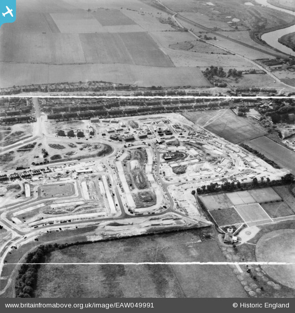
EAW049991 ENGLAND (1953). The residential area at Ferry Fryston under construction, Castleford, 1953. This image was marked by Aerofilms Ltd for photo editing.
© Copyright OpenStreetMap contributors and licensed by the OpenStreetMap Foundation. 2026. Cartography is licensed as CC BY-SA.
Nearby Images (9)
EAW049991

EAW049994

EAW049989

EAW049996

EAW049997

EAW049995

EAW049993

EAW049992

EAW049990

Details
| Title | [EAW049991] The residential area at Ferry Fryston under construction, Castleford, 1953. This image was marked by Aerofilms Ltd for photo editing. |
| Reference | EAW049991 |
| Date | 18-June-1953 |
| Link | |
| Place name | CASTLEFORD |
| Parish | |
| District | |
| Country | ENGLAND |
| Easting / Northing | 445536, 426326 |
| Longitude / Latitude | -1.3096881406782, 53.731115866927 |
| National Grid Reference | SE455263 |
