
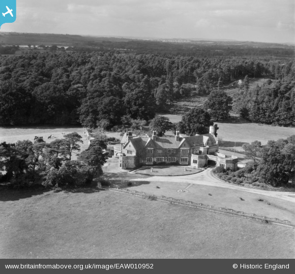
EAW010952 ENGLAND (1947). Trigon House, Trigon Hill, from the south-east, 1947
© Copyright OpenStreetMap contributors and licensed by the OpenStreetMap Foundation. 2026. Cartography is licensed as CC BY-SA.
Nearby Images (6)
EAW010952

EAW010954

EAW010955

EAW010951

EAW010950

EAW010960

Details
| Title | [EAW010952] Trigon House, Trigon Hill, from the south-east, 1947 |
| Reference | EAW010952 |
| Date | 24-September-1947 |
| Link | |
| Place name | TRIGON HILL |
| Parish | WAREHAM ST. MARTIN |
| District | |
| Country | ENGLAND |
| Easting / Northing | 388669, 88925 |
| Longitude / Latitude | -2.1604606998172, 50.699281147291 |
| National Grid Reference | SY887889 |
Pins
Be the first to add a comment to this image!