
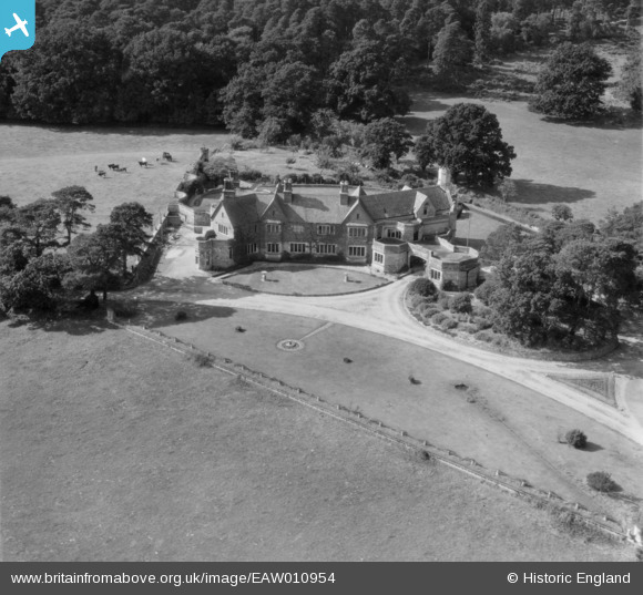
EAW010954 ENGLAND (1947). Trigon House, Trigon Hill, 1947
© Copyright OpenStreetMap contributors and licensed by the OpenStreetMap Foundation. 2026. Cartography is licensed as CC BY-SA.
Nearby Images (6)
EAW010954

EAW010955

EAW010951

EAW010952

EAW010950

EAW010960

Details
| Title | [EAW010954] Trigon House, Trigon Hill, 1947 |
| Reference | EAW010954 |
| Date | 24-September-1947 |
| Link | |
| Place name | TRIGON HILL |
| Parish | WAREHAM ST. MARTIN |
| District | |
| Country | ENGLAND |
| Easting / Northing | 388651, 88948 |
| Longitude / Latitude | -2.1607163075636, 50.699487651404 |
| National Grid Reference | SY887889 |
Pins
Be the first to add a comment to this image!
User Comment Contributions
Trigon House is Grade II listed, and dates from circ 1911. See https://www.historicengland.org.uk/listing/the-list/list-entry/1323437 for detailed information on this building. |

John W |
Thursday 12th of May 2016 05:23:20 PM |