
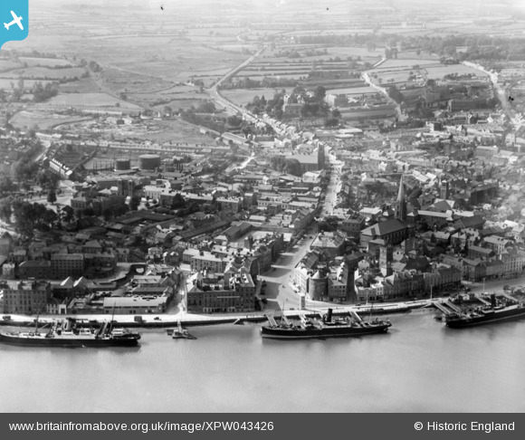
XPW043426 IRELAND (1933). General View, Waterford, Kilkenny, Ireland, 1933. Oblique aerial photograph taken facing South.
© Copyright OpenStreetMap contributors and licensed by the OpenStreetMap Foundation. 2026. Cartography is licensed as CC BY-SA.
Nearby Images (7)
XPW043426

XPW042403

XPW043435

XAW018979

XPW043434

XPW043436

XPW042400

Details
| Title | [XPW043426] General View, Waterford, Kilkenny, Ireland, 1933. Oblique aerial photograph taken facing South. |
| Reference | XPW043426 |
| Date | 1933 |
| Link | |
| Place name | WATERFORD |
| Parish | IRELAND |
| District | |
| Country | IRELAND |
| Easting / Northing | 51631, 274559 |
| Longitude / Latitude | -7.106935, 52.258546 |
| National Grid Reference |
Pins

ofarrl1960 |
Saturday 2nd of November 2019 09:06:54 PM | |
|
ofarrl1960 |
Saturday 11th of November 2017 01:32:48 AM | |
|
ofarrl1960 |
Saturday 11th of November 2017 01:30:15 AM | |
|
gBr |
Saturday 12th of September 2015 11:00:31 PM |