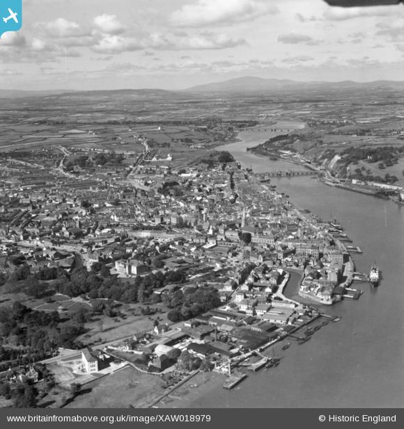
XAW018979 IRELAND (1948). General View, Waterford, Kilkenny, Ireland, 1948. Oblique aerial photograph taken facing North/West.
© Copyright OpenStreetMap contributors and licensed by the OpenStreetMap Foundation. 2024. Cartography is licensed as CC BY-SA.
Nearby Images (8)
Details
Title | [XAW018979] General View, Waterford, Kilkenny, Ireland, 1948. Oblique aerial photograph taken facing North/West. |
Reference | XAW018979 |
Date | 21-September-1948 |
Link | |
Place name | WATERFORD |
Parish | IRELAND |
District | |
Country | IRELAND |
Easting / Northing | 51641, 274701 |
Longitude / Latitude | -7.106931, 52.259822 |
National Grid Reference |
Pins
Newrath, Co.Kilkenny |
John Swain |
Friday 10th of October 2014 11:37:34 AM |
Gibbethill |
John Swain |
Friday 10th of October 2014 11:36:40 AM |
Bilberry Rock |
John Swain |
Friday 10th of October 2014 11:35:17 AM |
Waterford Iron Foundry at South Station, the former terminus of the Waterford, Dungarvan & Lismore Railway, 1878-1906, until the opening of the Suir Railway Bridge. Waterford South closed to passengers on Dec.31, 1907, and the signal cabin was dispensed with four years later. During the Great War, the nearby land was used as a munitions factory from 1916, which, in turn, was followed by the Neptune Iron Works in 1919, later renamed as the Waterford Ironfounders Ltd. Freight traffic continued to use the station and railway line until 1974. |
John Swain |
Friday 10th of October 2014 11:33:46 AM |
Waterford North Station at Mount Misery, County Waterford, in CIE times (Coras Iompair Eireann), formerly Great Southern Railways until 1945. |
John Swain |
Friday 10th of October 2014 11:22:58 AM |
The distinctive shape of Slievenamon (2,363 feet) in County Tipperary, which was climbed on many occasions by this contributor from 1998 to 2004. |
John Swain |
Friday 10th of October 2014 11:19:54 AM |
Middle section of the River Suir, which initially forms the boundary between Waterford and Kilkenny and then between Waterford and South Tipperary. |
John Swain |
Friday 10th of October 2014 11:17:32 AM |
Suir Railway Bridge was opened in 1906, which enabled passenger boat trains to enter Waterford North station before moving east towards Rosslare. Built by the famous Scottish engineer, Sir Robert McAlpine, the Suir Bridge was a nine-span opening structure, 1205 feet in length with an 80-foot span in the centre. The bridge was closed in 1982 and has been partially dismantled, with the central section removed to Newrath, on the north bank, as recently as 1996. |
John Swain |
Friday 10th of October 2014 11:15:16 AM |
Waterford Bridge |
John Swain |
Friday 10th of October 2014 11:07:00 AM |
Commercial, ecclesiastical and administrative core of the old historic city of Waterford. |
John Swain |
Friday 10th of October 2014 11:06:03 AM |
Confluence of the Suir and John's rivers at Scotch Quay |
John Swain |
Friday 10th of October 2014 11:04:21 AM |