
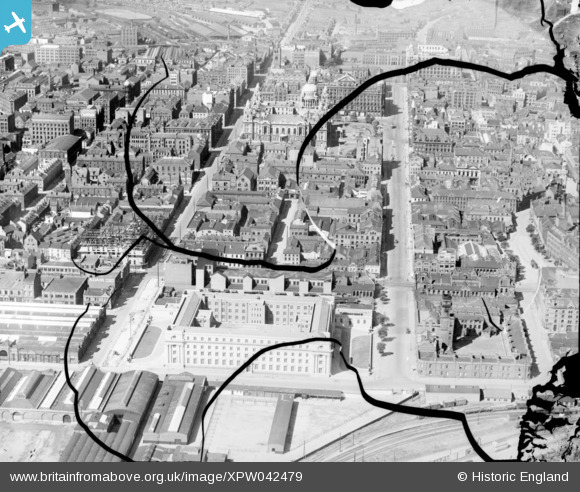
XPW042479 NORTHERN IRELAND (1933). General View, Belfast, Belfast, Northern Ireland, 1933. Oblique aerial photograph taken facing West. This image has been produced from a damaged negative.
© Copyright OpenStreetMap contributors and licensed by the OpenStreetMap Foundation. 2026. Cartography is licensed as CC BY-SA.
Nearby Images (9)
XPW042479

XAW033116

XAW027627

XPW028755

XAW009546

XPW015311

XAW027628

XAW033114

XPW015520

Details
| Title | [XPW042479] General View, Belfast, Belfast, Northern Ireland, 1933. Oblique aerial photograph taken facing West. This image has been produced from a damaged negative. |
| Reference | XPW042479 |
| Date | 1933 |
| Link | |
| Place name | BELFAST |
| Parish | NORTHERN IRELAND |
| District | |
| Country | NORTHERN IRELAND |
| Easting / Northing | 146477, 529487 |
| Longitude / Latitude | -5.926394, 54.596776 |
| National Grid Reference |
Pins
Be the first to add a comment to this image!