
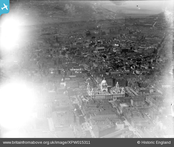
XPW015311 NORTHERN IRELAND (1926). Belfast City Hall, Belfast, Belfast, Northern Ireland, 1926. Oblique aerial photograph taken facing North.
© Copyright OpenStreetMap contributors and licensed by the OpenStreetMap Foundation. 2026. Cartography is licensed as CC BY-SA.
Nearby Images (15)
XPW015311

XPW028755

XAW027628

XAW033116

XPW028756

XPW042478

XAW033114

XAW033113

XPW015520

XPW015325

XAW009546

XAW033115

XPW042479

XAW027625

XPW008414

Details
| Title | [XPW015311] Belfast City Hall, Belfast, Belfast, Northern Ireland, 1926. Oblique aerial photograph taken facing North. |
| Reference | XPW015311 |
| Date | 1926 |
| Link | |
| Place name | BELFAST |
| Parish | NORTHERN IRELAND |
| District | |
| Country | NORTHERN IRELAND |
| Easting / Northing | 146253, 529573 |
| Longitude / Latitude | -5.929916, 54.597435 |
| National Grid Reference |
Pins

samguthrie91 |
Monday 7th of July 2025 10:32:29 PM |