
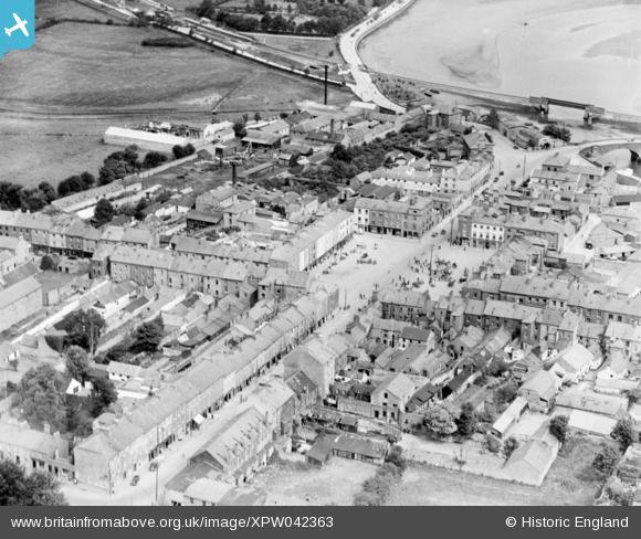
XPW042363 IRELAND (1933). Market Square, Dungarvan, Waterford, Ireland, 1933. Oblique aerial photograph taken facing North.
© Copyright OpenStreetMap contributors and licensed by the OpenStreetMap Foundation. 2026. Cartography is licensed as CC BY-SA.
Nearby Images (6)
XPW042363

XPW042364

XPW042361

XPW042365

XPW042362

XPW042366

Details
| Title | [XPW042363] Market Square, Dungarvan, Waterford, Ireland, 1933. Oblique aerial photograph taken facing North. |
| Reference | XPW042363 |
| Date | 1933 |
| Link | |
| Place name | DUNGARVAN |
| Parish | IRELAND |
| District | |
| Country | IRELAND |
| Easting / Northing | 15103, 258541 |
| Longitude / Latitude | -7.621446, 52.090915 |
| National Grid Reference |
Pins

John Swain |
Thursday 9th of October 2014 02:38:01 PM | |
|
John Swain |
Thursday 9th of October 2014 02:32:12 PM | |
|
John Swain |
Thursday 9th of October 2014 02:31:39 PM | |
|
John Swain |
Thursday 9th of October 2014 02:30:56 PM | |
|
John Swain |
Thursday 9th of October 2014 02:26:20 PM | |
|
John Swain |
Thursday 9th of October 2014 02:24:35 PM | |
|
John Swain |
Thursday 9th of October 2014 02:22:21 PM | |
|
John Swain |
Thursday 9th of October 2014 02:21:27 PM | |
|
John Swain |
Thursday 9th of October 2014 02:20:28 PM | |
|
John Swain |
Thursday 9th of October 2014 02:19:47 PM |