
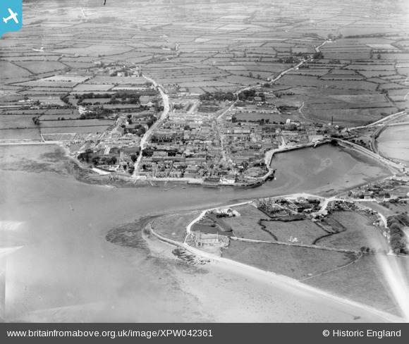
XPW042361 IRELAND (1933). General View, Dungarvan, Waterford, Ireland, 1933. Oblique aerial photograph taken facing West.
© Copyright OpenStreetMap contributors and licensed by the OpenStreetMap Foundation. 2026. Cartography is licensed as CC BY-SA.
Nearby Images (8)
XPW042361

XPW042365

XPW042362

XPW042363

XPW042364

XPW042366

XPW042368

XPW042369

Details
| Title | [XPW042361] General View, Dungarvan, Waterford, Ireland, 1933. Oblique aerial photograph taken facing West. |
| Reference | XPW042361 |
| Date | 1933 |
| Link | |
| Place name | DUNGARVAN |
| Parish | IRELAND |
| District | |
| Country | IRELAND |
| Easting / Northing | 15140, 258433 |
| Longitude / Latitude | -7.620793, 52.089974 |
| National Grid Reference |
Pins

powerpop |
Sunday 19th of October 2014 12:52:08 PM |