
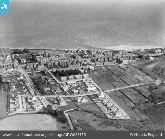
XPW028735 NORTHERN IRELAND (1929). Seafront, Newcastle, Down, Northern Ireland, 1929. Oblique aerial photograph taken facing East.
© Copyright OpenStreetMap contributors and licensed by the OpenStreetMap Foundation. 2026. Cartography is licensed as CC BY-SA.
Nearby Images (5)
XPW028735

XPW028736

XPW028739

XPW028734

XPW028738

Details
| Title | [XPW028735] Seafront, Newcastle, Down, Northern Ireland, 1929. Oblique aerial photograph taken facing East. |
| Reference | XPW028735 |
| Date | 1929 |
| Link | |
| Place name | NEWCASTLE |
| Parish | NORTHERN IRELAND |
| District | |
| Country | NORTHERN IRELAND |
| Easting / Northing | 146473, 486635 |
| Longitude / Latitude | -5.889858, 54.212561 |
| National Grid Reference |
Pins
Be the first to add a comment to this image!