
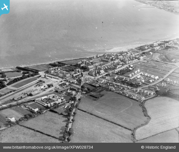
XPW028734 NORTHERN IRELAND (1929). General View, Newcastle, Down, Northern Ireland, 1929. Oblique aerial photograph taken facing South.
© Copyright OpenStreetMap contributors and licensed by the OpenStreetMap Foundation. 2026. Cartography is licensed as CC BY-SA.
Nearby Images (6)
XPW028734

XPW028739

XPW028736

XPW028735

XPW028741

XPW028738

Details
| Title | [XPW028734] General View, Newcastle, Down, Northern Ireland, 1929. Oblique aerial photograph taken facing South. |
| Reference | XPW028734 |
| Date | 1929 |
| Link | |
| Place name | NEWCASTLE |
| Parish | NORTHERN IRELAND |
| District | |
| Country | NORTHERN IRELAND |
| Easting / Northing | 146519, 486770 |
| Longitude / Latitude | -5.889267, 54.213794 |
| National Grid Reference |
Pins

Coolian |
Thursday 30th of October 2014 03:29:43 PM |