
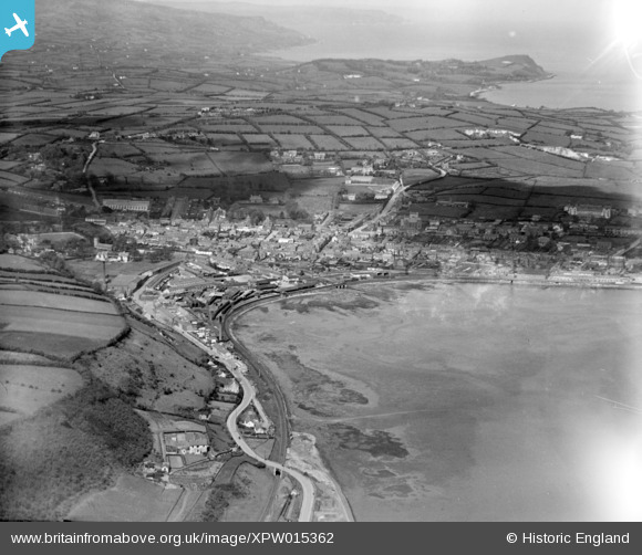
XPW015362 NORTHERN IRELAND (1926). Town and Bay, Larne, Larne, Northern Ireland, 1926. Oblique aerial photograph taken facing North.
© Copyright OpenStreetMap contributors and licensed by the OpenStreetMap Foundation. 2026. Cartography is licensed as CC BY-SA.
Nearby Images (2)
XPW015362

XPW015361

Details
| Title | [XPW015362] Town and Bay, Larne, Larne, Northern Ireland, 1926. Oblique aerial photograph taken facing North. |
| Reference | XPW015362 |
| Date | 1926 |
| Link | |
| Place name | LARNE |
| Parish | NORTHERN IRELAND |
| District | |
| Country | NORTHERN IRELAND |
| Easting / Northing | 155201, 557353 |
| Longitude / Latitude | -5.815088, 54.850945 |
| National Grid Reference |
Pins

rcurrie |
Monday 30th of December 2019 03:05:06 PM | |
|
Stephen Craig |
Monday 1st of December 2014 01:49:57 PM | |
|
Stephen Craig |
Monday 1st of December 2014 01:48:23 PM |