
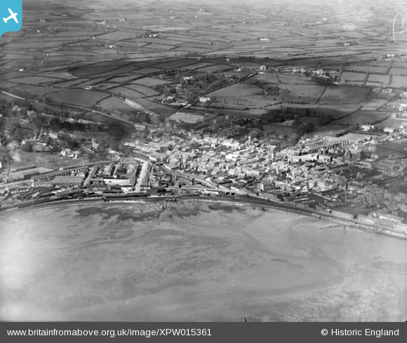
XPW015361 NORTHERN IRELAND (1926). General View, Larne, Larne, Northern Ireland, 1926. Oblique aerial photograph taken facing North/West.
© Copyright OpenStreetMap contributors and licensed by the OpenStreetMap Foundation. 2026. Cartography is licensed as CC BY-SA.
Nearby Images (2)
XPW015361

XPW015362

Details
| Title | [XPW015361] General View, Larne, Larne, Northern Ireland, 1926. Oblique aerial photograph taken facing North/West. |
| Reference | XPW015361 |
| Date | 1926 |
| Link | |
| Place name | LARNE |
| Parish | NORTHERN IRELAND |
| District | |
| Country | NORTHERN IRELAND |
| Easting / Northing | 155080, 557166 |
| Longitude / Latitude | -5.816815, 54.849211 |
| National Grid Reference |
Pins

Ulsterman |
Friday 6th of March 2015 05:39:41 PM |