
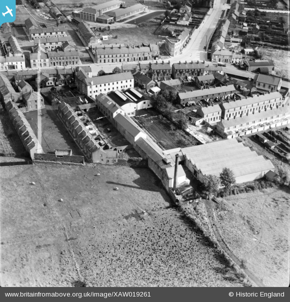
XAW019261 NORTHERN IRELAND (1948). Warp Knitters Ltd, Queen Street, Lurgan, Craigavon, Northern Ireland, 1948. Oblique aerial photograph taken facing North/East. This image was marked by Aerofilms Ltd for photo editing.
© Copyright OpenStreetMap contributors and licensed by the OpenStreetMap Foundation. 2026. Cartography is licensed as CC BY-SA.
Nearby Images (10)
XAW019261

XAW019260

XAW019259

XAW019258

XAW019257

XAW019263

XAW019262

XAW032764

XPW042440

XAW027106

Details
| Title | [XAW019261] Warp Knitters Ltd, Queen Street, Lurgan, Craigavon, Northern Ireland, 1948. Oblique aerial photograph taken facing North/East. This image was marked by Aerofilms Ltd for photo editing. |
| Reference | XAW019261 |
| Date | 25-September-1948 |
| Link | |
| Place name | LURGAN |
| Parish | NORTHERN IRELAND |
| District | |
| Country | NORTHERN IRELAND |
| Easting / Northing | 119876, 515576 |
| Longitude / Latitude | -6.32375, 54.458076 |
| National Grid Reference |
Pins
Be the first to add a comment to this image!