
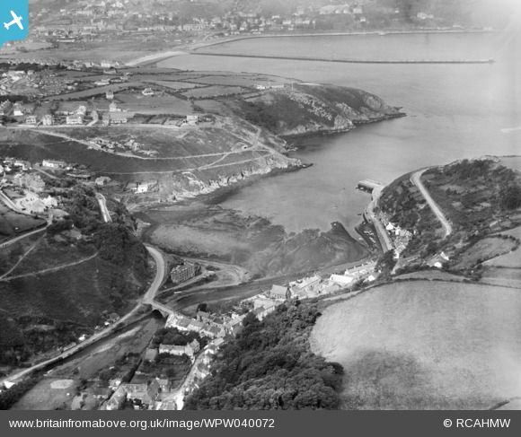
WPW040072 WALES (1932). General view of Fishguard, showing Fishguard Quay, oblique aerial view. 5"x4" black and white glass plate negative.
© Copyright OpenStreetMap contributors and licensed by the OpenStreetMap Foundation. 2026. Cartography is licensed as CC BY-SA.
Nearby Images (16)
WPW029646

WPW029647

WPW029648

WPW029649

WPW029650

WPW029651

WPW029652

WPW029653

WPW029659

WPW029660

WPW040067

WPW040068

WPW040069

WPW040070

WPW040072

WPW040073

Details
| Title | [WPW040072] General view of Fishguard, showing Fishguard Quay, oblique aerial view. 5"x4" black and white glass plate negative. |
| Reference | WPW040072 |
| Date | 1932 |
| Link | Coflein Archive Item 6369685 |
| Place name | |
| Parish | |
| District | |
| Country | WALES |
| Easting / Northing | 195760, 237004 |
| Longitude / Latitude | -4.9752408634922, 51.993438477543 |
| National Grid Reference | SM958370 |
Pins

User Comment Contributions
Did you know that 'The last invasion of Britain' happened at Fishguard and Lower Town harbour in 1797.It took place between the 22nd & 24th of February, by an invading force of Revolutionary France. |
Robert Tims |
Wednesday 25th of September 2013 02:39:39 PM |