
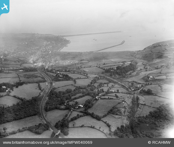
WPW040069 WALES (1932). Distant view of Fishguard, oblique aerial view. 5"x4" black and white glass plate negative.
© Copyright OpenStreetMap contributors and licensed by the OpenStreetMap Foundation. 2026. Cartography is licensed as CC BY-SA.
Nearby Images (16)
WPW029646

 0°
0m
0°
0m
WPW029647
 0°
0m
0°
0m
WPW029648
 0°
0m
0°
0m
WPW029649
 0°
0m
0°
0m
WPW029650
 0°
0m
0°
0m
WPW029651
 0°
0m
0°
0m
WPW029652
 0°
0m
0°
0m
WPW029653
 0°
0m
0°
0m
WPW029659
 0°
0m
0°
0m
WPW029660
 0°
0m
0°
0m
WPW040067
 0°
0m
0°
0m
WPW040068
 0°
0m
0°
0m
WPW040069
 0°
0m
0°
0m
WPW040070
 0°
0m
0°
0m
WPW040072
 0°
0m
0°
0m
WPW040073
 0°
0m
0°
0m
Details
| Title | [WPW040069] Distant view of Fishguard, oblique aerial view. 5"x4" black and white glass plate negative. |
| Reference | WPW040069 |
| Date | 1932 |
| Link | Coflein Archive Item 6369682 |
| Place name | |
| Parish | |
| District | |
| Country | WALES |
| Easting / Northing | 195760, 237004 |
| Longitude / Latitude | -4.9752408634922, 51.993438477543 |
| National Grid Reference | SM958370 |
Pins
 Castle Martin (now Cwmbrandy Gardens) Castle Martin (now Cwmbrandy Gardens) |

PeteS |
Thursday 22nd of August 2024 08:07:33 AM |
| New GWR railway between Fishguard and Letterston authorised in 1903 but abandoned during the World War 1 before completion. |
Andy Kirkham |
Monday 1st of August 2016 08:55:33 AM |
| North Breakwater |
MB |
Friday 19th of October 2012 02:21:14 PM |
| Probable location of engine shed |
MB |
Friday 19th of October 2012 02:20:52 PM |
| Train at Fishguard and Goodwick Station |
MB |
Friday 19th of October 2012 02:20:16 PM |
| Hillside |
Paul Evans |
Saturday 14th of July 2012 12:10:27 PM |