
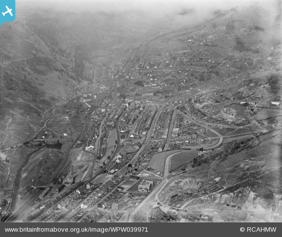
WPW039971 WALES (1932). General view of Abertillery, oblique aerial view. 5"x4" black and white glass plate negative.
© Copyright OpenStreetMap contributors and licensed by the OpenStreetMap Foundation. 2026. Cartography is licensed as CC BY-SA.
Nearby Images (4)
WPW039970

WPW039971

WPW039972

WPW039973

Details
| Title | [WPW039971] General view of Abertillery, oblique aerial view. 5"x4" black and white glass plate negative. |
| Reference | WPW039971 |
| Date | 1932 |
| Link | Coflein Archive Item 6370932 |
| Place name | |
| Parish | |
| District | |
| Country | WALES |
| Easting / Northing | 322000, 203000 |
| Longitude / Latitude | -3.129279169425, 51.719836134808 |
| National Grid Reference | SO220030 |
Pins

Reg Williams |
Friday 13th of December 2013 05:10:17 PM | |
|
Reg Williams |
Friday 13th of December 2013 05:08:08 PM | |
|
Reg Williams |
Friday 13th of December 2013 05:04:52 PM | |
|
Reg Williams |
Friday 13th of December 2013 05:04:20 PM | |
|
judgejeffriesjones |
Wednesday 23rd of January 2013 11:58:35 PM |
User Comment Contributions
The area marked as "Iron Foundry" was the Tin Works. The Iron Foundry was Just below the southern end of the Foundry bridge. |
Reg Williams |
Friday 13th of December 2013 04:04:26 PM |