
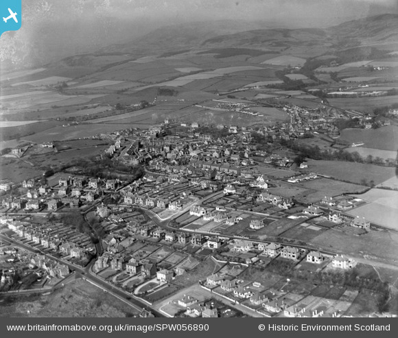
SPW056890 SCOTLAND (1938). West Kilbride, general view, showing Caldwell Road and Ritchie Street. An oblique aerial photograph taken facing north-east.
© Copyright OpenStreetMap contributors and licensed by the OpenStreetMap Foundation. 2026. Cartography is licensed as CC BY-SA.
Nearby Images (3)
SPW056890

SPW056889

SAR031706

Details
| Title | [SPW056890] West Kilbride, general view, showing Caldwell Road and Ritchie Street. An oblique aerial photograph taken facing north-east. |
| Reference | SPW056890 |
| Date | 1938 |
| Link | NRHE Collection item 1258241 |
| Place name | |
| Parish | WEST KILBRIDE |
| District | CUNNINGHAME |
| Country | SCOTLAND |
| Easting / Northing | 220331, 648200 |
| Longitude / Latitude | -4.8589588927091, 55.693938553097 |
| National Grid Reference | NS203482 |
