
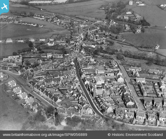
SPW056889 SCOTLAND (1938). West Kilbride, general view, showing Ritchie Street and St Andrews Church, Main Street. An oblique aerial photograph taken facing east.
© Copyright OpenStreetMap contributors and licensed by the OpenStreetMap Foundation. 2026. Cartography is licensed as CC BY-SA.
Nearby Images (3)
SPW056889

SAR031706

SPW056890

Details
| Title | [SPW056889] West Kilbride, general view, showing Ritchie Street and St Andrews Church, Main Street. An oblique aerial photograph taken facing east. |
| Reference | SPW056889 |
| Date | 1938 |
| Link | NRHE Collection item 1258240 |
| Place name | |
| Parish | WEST KILBRIDE |
| District | CUNNINGHAME |
| Country | SCOTLAND |
| Easting / Northing | 220521, 648272 |
| Longitude / Latitude | -4.8559869061628, 55.69465506324 |
| National Grid Reference | NS205483 |
Pins
Be the first to add a comment to this image!