
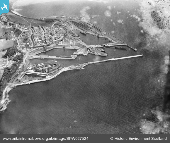
SPW027524 SCOTLAND (1929). Burntisland Harbour, Burntisland, Fife, Scotland, 1929. An oblique aerial photograph taken facing east. This image has been produced from a damaged negative.
© Copyright OpenStreetMap contributors and licensed by the OpenStreetMap Foundation. 2026. Cartography is licensed as CC BY-SA.
Nearby Images (10)
SPW027183

SPW027288

SPW027524

SPW027186

SPW027285

SPW027184

SAR016801

SAR016802

SAR031683

SPW027283

Details
| Title | [SPW027524] Burntisland Harbour, Burntisland, Fife, Scotland, 1929. An oblique aerial photograph taken facing east. This image has been produced from a damaged negative. |
| Reference | SPW027524 |
| Date | 1929 |
| Link | NRHE Collection item 1452004 |
| Place name | |
| Parish | BURNTISLAND |
| District | KIRKCALDY |
| Country | SCOTLAND |
| Easting / Northing | 322950, 685541 |
| Longitude / Latitude | -3.2373765373418, 56.056563861603 |
| National Grid Reference | NT230855 |
Pins
Be the first to add a comment to this image!