
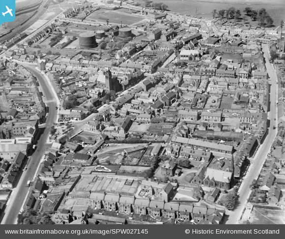
SPW027145 SCOTLAND (1929). Bathgate, general view, showing St David's Church and South Bridge Street. An oblique aerial photograph taken facing north.
© Copyright OpenStreetMap contributors and licensed by the OpenStreetMap Foundation. 2026. Cartography is licensed as CC BY-SA.
Nearby Images (7)
SPW027145

SPW027148

SPW027151

SPW027150

SPW027147

SPW027153

SPW027149

Details
| Title | [SPW027145] Bathgate, general view, showing St David's Church and South Bridge Street. An oblique aerial photograph taken facing north. |
| Reference | SPW027145 |
| Date | 1929 |
| Link | NRHE Collection item 1256720 |
| Place name | |
| Parish | BATHGATE |
| District | WEST LOTHIAN |
| Country | SCOTLAND |
| Easting / Northing | 297480, 668808 |
| Longitude / Latitude | -3.6398702659386, 55.901489453194 |
| National Grid Reference | NS975688 |
Pins

Rob McGinley |
Wednesday 18th of December 2019 10:14:41 AM |