
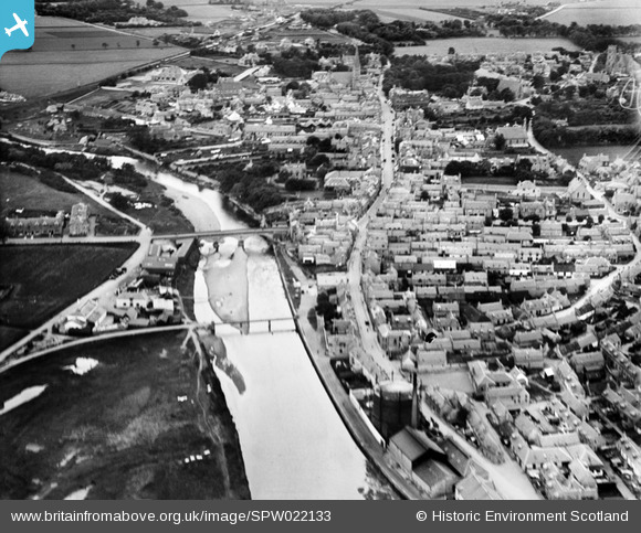
SPW022133 SCOTLAND (1928). Nairn, general view, showing Nairn Bridge and High Street. An oblique aerial photograph taken facing south-west.
© Copyright OpenStreetMap contributors and licensed by the OpenStreetMap Foundation. 2025. Cartography is licensed as CC BY-SA.
Nearby Images (4)
SPW022133

SPW033838

SPW040493

SPW040492

Details
| Title | [SPW022133] Nairn, general view, showing Nairn Bridge and High Street. An oblique aerial photograph taken facing south-west. |
| Reference | SPW022133 |
| Date | 1928 |
| Link | NRHE Collection item 1256503 |
| Place name | |
| Parish | NAIRN |
| District | NAIRN |
| Country | SCOTLAND |
| Easting / Northing | 288605, 856610 |
| Longitude / Latitude | -3.8634295070528, 57.586003329854 |
| National Grid Reference | NH886566 |
Pins
Be the first to add a comment to this image!