
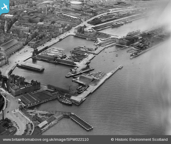
SPW022110 SCOTLAND (1928). Dundee, general view, showing King William IV Dock and Tidal Harbour. An oblique aerial photograph taken facing north.
© Copyright OpenStreetMap contributors and licensed by the OpenStreetMap Foundation. 2026. Cartography is licensed as CC BY-SA.
Nearby Images (16)
SPW022110

SPW022103

SPW019936

SPW019937

SPW019939

SPW040561

SPW042547

SPW040562

SAW009806

SAW014834

SPW022108

SAW019549

SAW051263

SAW051265

SPW019935

SPW019930

Details
| Title | [SPW022110] Dundee, general view, showing King William IV Dock and Tidal Harbour. An oblique aerial photograph taken facing north. |
| Reference | SPW022110 |
| Date | 1928 |
| Link | NRHE Collection item 1256483 |
| Place name | |
| Parish | DUNDEE (DUNDEE, CITY OF) |
| District | CITY OF DUNDEE |
| Country | SCOTLAND |
| Easting / Northing | 340617, 730066 |
| Longitude / Latitude | -2.9637069782547, 56.459099448778 |
| National Grid Reference | NO406301 |
Pins

Class31 |
Thursday 18th of April 2013 08:14:24 AM | |
|
Class31 |
Thursday 18th of April 2013 08:05:01 AM | |
|
Class31 |
Thursday 18th of April 2013 07:51:55 AM | |
|
Class31 |
Thursday 18th of April 2013 07:45:33 AM | |
|
Class31 |
Thursday 18th of April 2013 07:40:48 AM |