
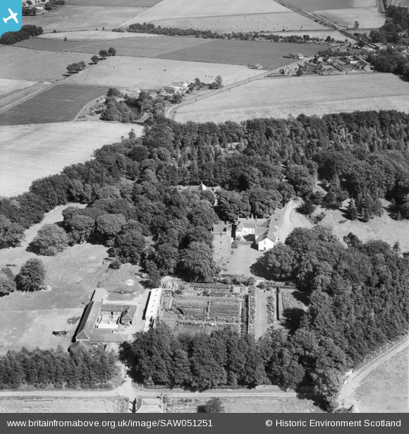
SAW051251 SCOTLAND (1953). Affleck Castle and Home Farm, Monikie. An oblique aerial photograph taken facing east.
© Copyright OpenStreetMap contributors and licensed by the OpenStreetMap Foundation. 2025. Cartography is licensed as CC BY-SA.
Nearby Images (3)
SAW051251

SAW051249

SAW051250

Details
| Title | [SAW051251] Affleck Castle and Home Farm, Monikie. An oblique aerial photograph taken facing east. |
| Reference | SAW051251 |
| Date | 1953 |
| Link | NRHE Collection item 1297912 |
| Place name | |
| Parish | MONIKIE |
| District | ANGUS |
| Country | SCOTLAND |
| Easting / Northing | 349431, 738786 |
| Longitude / Latitude | -2.8223792463999, 56.53846859212 |
| National Grid Reference | NO494388 |
Pins
Be the first to add a comment to this image!