
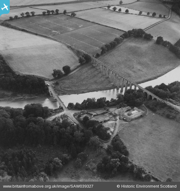
SAW039327 SCOTLAND (1951). Leaderfoot Viaduct and Road Bridge, Leaderfoot. An oblique aerial photograph taken facing south-west. This image has been produced from a print.
© Copyright OpenStreetMap contributors and licensed by the OpenStreetMap Foundation. 2025. Cartography is licensed as CC BY-SA.
Nearby Images (3)
SAW039326

SAW039327

SAW039325

Details
| Title | [SAW039327] Leaderfoot Viaduct and Road Bridge, Leaderfoot. An oblique aerial photograph taken facing south-west. This image has been produced from a print. |
| Reference | SAW039327 |
| Date | 1951 |
| Link | NRHE Collection item 1315279 |
| Place name | |
| Parish | MELROSE |
| District | ETTRICK AND LAUDERDALE |
| Country | SCOTLAND |
| Easting / Northing | 357385, 634743 |
| Longitude / Latitude | -2.6764639401816, 55.604430548675 |
| National Grid Reference | NT574347 |
Pins

Brian Wilkinson |
Friday 31st of January 2014 03:44:51 PM |